Laverton South
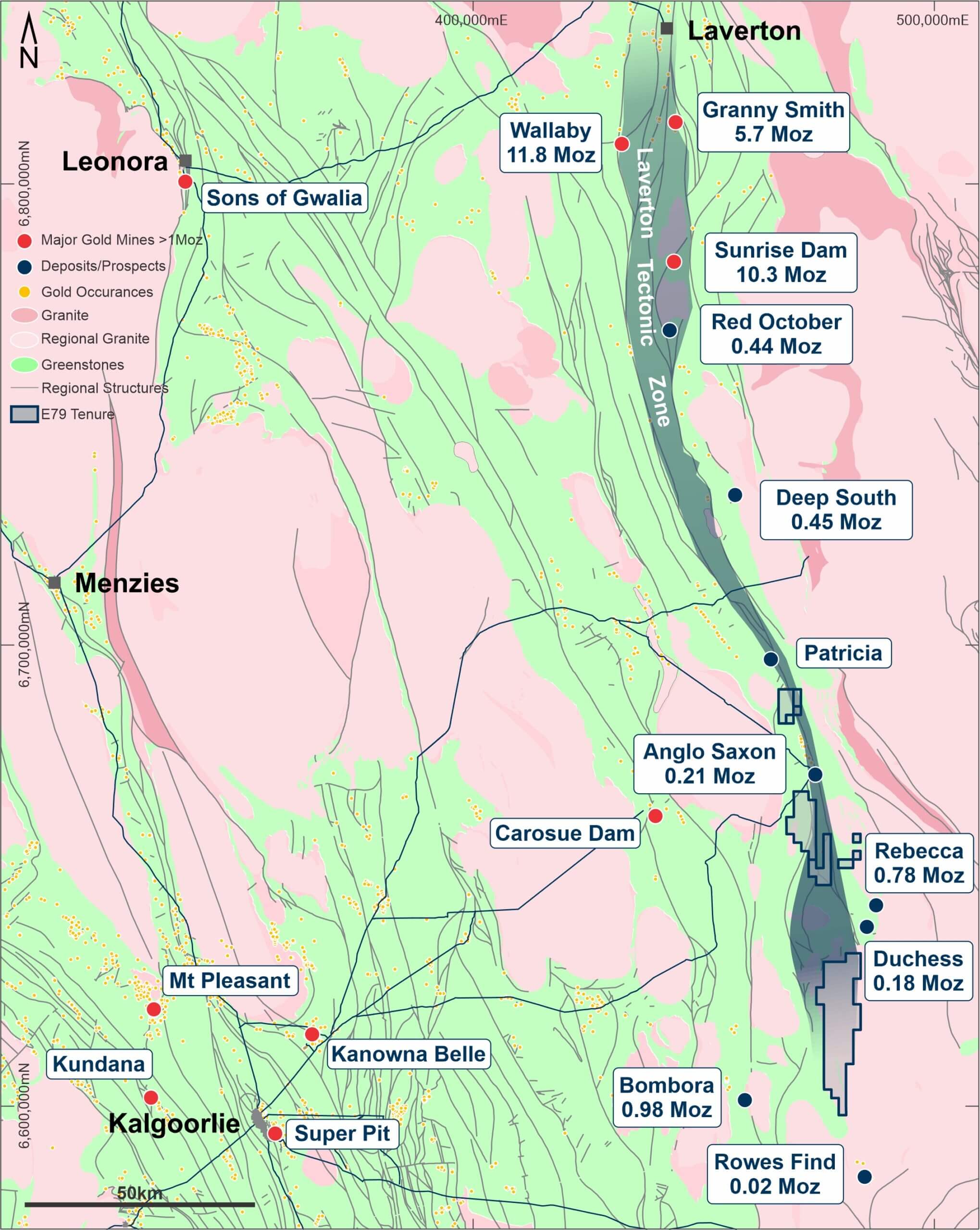
The Laverton South Project is located on Yindi, Pinjin and Edjudina Stations and vacant crown land in the North East Coolgardie Mineral Field, within the shire of Kalgoorlie-Boulder, 120 km east of Kalgoorlie, Western Australia. The Project can be reached via tracks east-south east of Yindi Homestead, or from the south via the Trans Australian Access Road from Kalgoorlie. Station tracks and fence lines provide access through quite dense eucalypt woodland and mulga/mallee scrub.
The Project includes ten exploration licenses, 100% owned.
The Laverton South Project is located within the Eastern Goldfields Superterrane of the Archean Yilgarn Craton in the southern extensions of the Laverton Tectonic Zone (“LTZ”), a 250 kilometre long and laterally extensive significant gold bearing structure. This tectonic zone is an early, deep seated and long-lived structure which has been a conduit for gold bearing fluids as evidenced by the world-class Wallaby and Sunrise Dam deposits, approximately 100 kms north of the Project.

The LTZ is a regional scale shear/fault system that manifests as a series of NNE and NNW structures. The western contact of the LTZ is defined by the Claypan Fault which in the immediate area separates the Edjudina Domain comprising lower greenschist facies, classic greenstone stratigraphy in the west, from the Pinjin Domain comprising folded, upper greenschist to amphibolite facies stratigraphy and granite gneiss in the east.
The Project lies predominantly east of the Claypan Fault, with a geological sequence comprising intercalated mafic to ultramafic volcanic rocks, felsic to intermediate volcanic rocks and siliclastic sedimentary units. Metamorphic grades generally increase from greenschist facies in the west to amphibolite facies in the east. In the eastern part of the Project area along the edge of the greenstone belt, the rocks are strongly deformed and predominantly comprise interleaved granite and mafic gneiss. Aeromagnetic images indicate increased structural complexity including tight isoclinal folds in gneissic units. This structural complexity is thought to be responsible for the significant gold mineralisation identified at the +1Moz Lake Rebecca Gold Project.
Importantly, basement geology within the Project area is overall poorly understood due to the presence of extensive transported cover that obscures much of the Project area. Transported cover includes lacustrine, alluvial, sheetwash and colluvial deposits of variable thicknesses. The Lake Raeside and Lake Rebecca drainage systems both pass through the Project area.
Gold and nickel mineralisation elsewhere in the LTZ occur within similar stratigraphy to the rocks underlying the Laverton South Project. The area has generated significant interest in recent times following ‘greenfield’ discoveries of the Bombora Deposit approximately 23 kms SW of the Laverton South Project where mineralisation is described as sulphide-impregnated ‘lode’ and stockwork mineralisation in the upper, iron-rich part of a thick fractionated dolerite and the Lake Rebecca Gold Project (1.03Moz), which is strategically located between the tenements comprising the Laverton South Project, gold mineralisation is associated with disseminated sulphide in a gneissic host rock.
Known gold deposits within the Laverton Tectonic Zone include Granny Smith, Wallaby, Sunrise Dam, Deep South, Red October, Anglo Saxon (Trouser Leg), Rebecca, Bombora, Duchess and Rowes Find.

